Guide

Things to do around Coral Bay

Caves, gorges, ancient mosaics and secluded coves: the best day-trip destinations near our villas – with driving times from Coral Bay.

Right on the doorstep
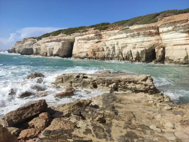
Limestone cliffs of the Sea Caves near Peyia
Coast

Sea Caves near Peyia

  • Getting there: approx. 6 km · 10 min

Rugged limestone coastline with caves, rock arches and crystal-clear water – one of the most popular photo spots in the region, especially at sunset. When the sea is calm, the brave jump into the water here; watch out for waves and slippery rocks.

Sea Caves & Edro III shipwreck: directions & tips →

More about the Sea Caves

The Sea Caves near Paphos lie on the Peyia coastline, about a 10-minute drive from our villas. Over a long time, wind and waves have carved caves, arches and little coves into the pale limestone. Depending on the light, the water glows turquoise to deep blue – no wonder the sea caves are one of the most popular photo spots in western Cyprus.

The EDRO III shipwreck

Right next to them lies the wreck of the EDRO III. The cargo ship ran aground in heavy seas on 8 December 2011 and has rested at an angle on the rocks ever since – according to Peyia Municipality there are officially no plans to remove it. A short coastal walk leads from the parking area at the caves to the wreck. Please only view it from the shore and don’t climb onto it.

Good to know

  • Parking: right on the coast next to the caves.
  • Best time: late afternoon until sunset, when the cliffs turn golden. Mornings are quieter.
  • Swimming & snorkelling: only when the sea is calm. In waves the rocks are dangerous; cliff jumping is at your own risk.
  • Footwear: sturdy soles – the limestone is sharp and can be slippery.
Tip from Kimmy & Christian: The Sea Caves are our favourite spot for a glass of wine or a cold beer at sunset. Bring a drink, find a spot on the rocks and watch the sun sink into the sea – then head to Coral Bay for dinner.

From our villas Asteria and Halia you’re here in a few minutes – perfect for a spontaneous sunset. Check availability →

Open in Google Maps ↗

Photo: Fry72, Karel Frydrýšek / Wikimedia Commons, CC BY-SA 4.0, cropped

Blue-and-yellow macaw at Pafos Zoo
Family

Paphos Zoo

  • Getting there: approx. 7 km · 11 min

Giraffes, tigers, kangaroos and one of the largest parrot collections in Europe (according to the zoo), plus the parrot and owl show three times a day. Open daily from 9:00 – great for families.

Paphos Zoo: animals, bird show & opening times →

Open in Google Maps ↗

Photo: Leonid Mamchenkov / Wikimedia Commons, CC BY 2.0, cropped

Harbour · culture

Agios Georgios (Peyia)

  • Getting there: approx. 8 km · 11 min

Small fishing harbour with a white chapel on the clifftop and the remains of early Christian basilicas. The uninhabited island of Yeronisos lies just offshore. A good starting point for the Akamas Peninsula.

More about Agios Georgios

On Cape Drepanon, Agios Georgios is a small fishing harbour below a cliff topped by a white chapel. Just above it are the remains of an early Christian settlement, and offshore lies the uninhabited island of Yeronisos. It is a place of pilgrimage and also the gateway to the Akamas Peninsula: the tracks towards Lara start here. Late afternoon is a lovely time to come, when the light over the cape softens.

History

Between 1952 and 1955 the Department of Antiquities uncovered three early Christian basilicas and a 6th-century bath here. Some floors have mosaics with animal scenes. The settlement flourished under Emperor Justinian I and was gradually abandoned in the first half of the 7th century. The small chapel of St George dates from the late 13th or early 14th century.

Good to know

  • Archaeological site: The site keeps its own hours. Check opening times and admission before you go.
  • Rock-cut tombs: Tombs cut into the rock, some with carved crosses, line the steep western coast. Stay on the paths and keep back from the edge.
  • Yeronisos: The island has traces from the Hellenistic to the early Christian period. You can see it from the cape.
  • Starting point: Gravel tracks lead from here to the Akamas Peninsula and Lara Bay.
Tip: Combine your visit with the Sea Caves, which are on the way, for coast and history in a single afternoon.

From our villas Asteria and Halia it’s about 11 minutes to the harbour, close enough for a spur-of-the-moment sunset trip. Check availability →

Open in Google Maps ↗

Village

Peyia village centre

  • Getting there: approx. 4 km · 8 min

The hill village above Coral Bay, with its village square, church, tavernas and views over the coast. This is where you get a feel for traditional Cyprus away from the beach crowds.

More about Peyia village centre

Above Coral Bay, Peyia sits on the hillsides at the southern edge of the Akamas Peninsula. The heart of the village is its paved square: the church and fountain form the old core around which Peyia grew. Cafés and traditional tavernas are right beside it, and the square also hosts events. Up here life feels calmer than on the coast, and the slopes give you views out over the sea.

The village fountain

The fountain on the square, “Vrisi ton Peyiotisson”, was built in 1908, reportedly on the very spot of an older one. Until 1956 it was the village’s main source of drinking water, and an old folk song has made it known across Cyprus.

Good to know

  • What you’ll find: A village square with a church, the historic fountain, cafés and tavernas.
  • Best time: Evenings, when the square livens up and the heat eases.
  • Time needed: An hour is enough for a stroll and a coffee. Allow longer for dinner.
  • Location: Peyia is about 14 km north-west of Paphos.
Tip: Take a closer look at the 1908 fountain. Its arches and large cistern show how the village once collected water from the rock.

From our villas Asteria and Halia the village centre is about 8 minutes away, ideal for dinner out without a long drive. Check availability →

Open in Google Maps ↗

Paphos

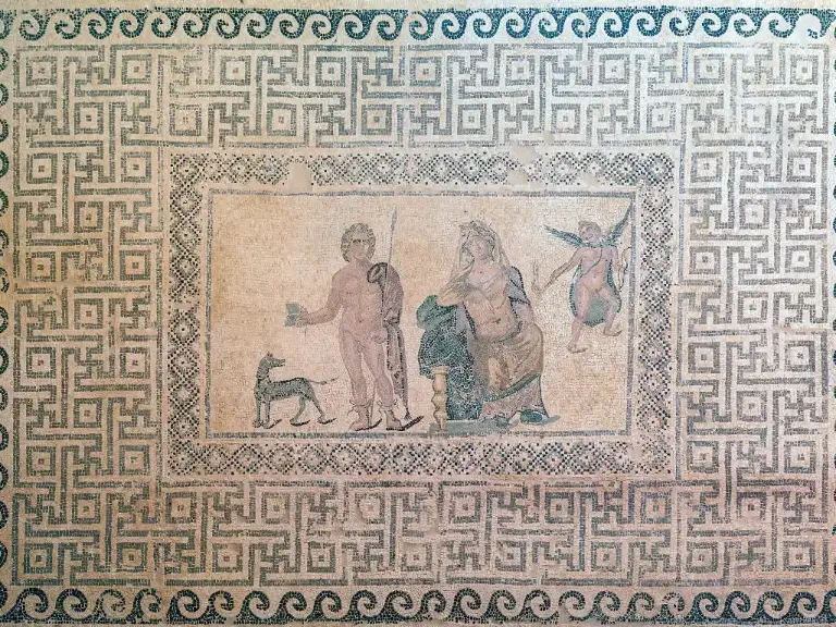
Mosaic in the House of Dionysus, Paphos Archaeological Park
UNESCO World Heritage

Paphos Archaeological Park

  • Getting there: approx. 13 km · 20 min

The excavation site of Nea Paphos, with famous Roman floor mosaics in the ancient villas, plus an odeon and ruins. Part of the Paphos UNESCO World Heritage Site. Allow at least two hours and bring sun protection – there is little shade.

Paphos Archaeological Park: mosaics, fee & tips →

More about Paphos Archaeological Park

Paphos Archaeological Park in Kato Paphos covers the site of Nea Paphos, the ancient city by the harbour. Its highlights are the mosaic floors of four Roman villas, the Houses of Dionysos, Theseus, Aion and Orpheus, which show scenes from Greek mythology. You’ll also find the Odeon and the ruins of the Saranta Kolones castle. The site has been a UNESCO World Heritage Site since 1980.

History

At the end of the 4th century BC, Nikokles, the last king of Palaipaphos, moved the city to its present site by the harbour. From the 2nd century BC to the 4th century AD, Paphos was the capital of Cyprus. Most of the remains are Roman. The Odeon was built in the 2nd century AD and seated around 1,200 people.

Good to know

  • Time needed: Allow at least two hours. The site is large.
  • Sun: There’s little shade, so bring sun protection and water.
  • Best time: Early morning or late afternoon, when it’s cooler.
  • Opening hours & admission: These vary by season, so check before you go. Individual mosaic houses can close temporarily for conservation work.
Tip: Start with the mosaic houses while the light is still low. That’s when the colours and details show up best.

From our villas Asteria and Halia it’s around 20 minutes to the park, so you can see the mosaics in the morning and be back by the pool in the afternoon. Check availability →

Open in Google Maps ↗

Photo: Diego Delso / Wikimedia Commons, CC BY-SA 4.0, cropped

Rock-cut tomb with peristyle court, Tombs of the Kings, Paphos
UNESCO World Heritage

Tombs of the Kings

  • Getting there: approx. 11 km · 16 min

Rock-cut tombs from the Hellenistic and Roman periods, some with columned courtyards. Despite the name, no kings were buried here, but high officials and aristocrats.

Tombs of the Kings: opening times, fee & tips →

More about the Tombs of the Kings

About two kilometres north of the harbour lies the necropolis known as the Tombs of the Kings Paphos. The burial chambers are cut straight into the rock. Some have courtyards lined with Doric columns, modelled on the houses of the living. No kings were buried here, though: the name comes from the tombs’ grandeur, and they held high officials and aristocrats. The site is part of the Paphos UNESCO World Heritage Site.

Background

Many tombs date from the 4th century BC and were used until the 3rd century AD. The first scientific excavations took place in 1915, and systematic digs began in the late 1970s. Grave robbers removed most of the burial goods long ago.

Good to know

  • Time needed: About one to two hours.
  • Footwear: Wear sturdy shoes. Steps lead down into the chambers and the ground is uneven.
  • Sun: The site is open and close to the sea, so bring sun protection.
  • Opening hours & admission: Separate ticket. Check opening times and admission before you go.
Tip: Climb down into one of the large tombs with a columned courtyard. It’s noticeably cooler down there, and the architecture only really makes sense from inside.

From our villas Asteria and Halia it’s just 16 minutes to the tombs, easy to pair with the Archaeological Park in one morning. Check availability →

Open in Google Maps ↗

Photo: Seainme / Wikimedia Commons, CC BY-SA 4.0, cropped
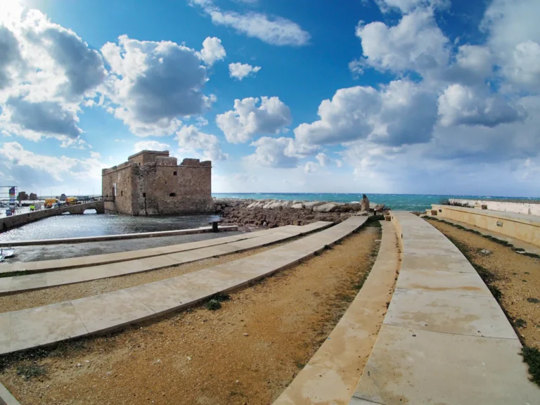
Paphos Castle at the harbour with the pier
Promenade

Paphos harbour · castle

  • Getting there: approx. 13 km · 20 min

Harbour promenade with cafés, restaurants and the small fort at the end of the pier. Many boat trips also leave from here. Lovely for an evening stroll.

Paphos Harbour & Castle: opening times, fee & tips →

More about Paphos harbour and castle

Paphos harbour is made for strolling. Cafés and restaurants line the promenade, and many boat trips set off from here. At the end of the breakwater stands the small castle, the harbour’s landmark. The Archaeological Park is right next door, so many visitors pair it with a walk along the water.

The castle’s history

The Lusignans built the castle in the 13th century after an earthquake in 1222 destroyed the older Saranta Kolones fortress. In 1570 the Venetians destroyed the western tower so the Ottomans couldn’t use it. The Ottomans rebuilt it in 1592, as an inscription above the entrance records. Under British administration it served as a salt store, and in 1935 it was declared an ancient monument.

Good to know

  • Promenade: Free to walk. It’s busiest in the evening.
  • Castle: Check opening times and admission before you go. It has closed temporarily for conservation work in the past.
  • Boat trips: Many excursions leave from the harbour. Check departure times with the operator.
  • Time needed: One to two hours, longer if you stay for a meal.
Tip: Come at sunset and walk to the end of the breakwater for a view of the castle and harbour in the evening light.

From our villas Asteria and Halia the harbour is around 20 minutes away, an easy evening outing with dinner by the water. Check availability →

Open in Google Maps ↗

Photo: Nikolai Rubanov / Unsplash

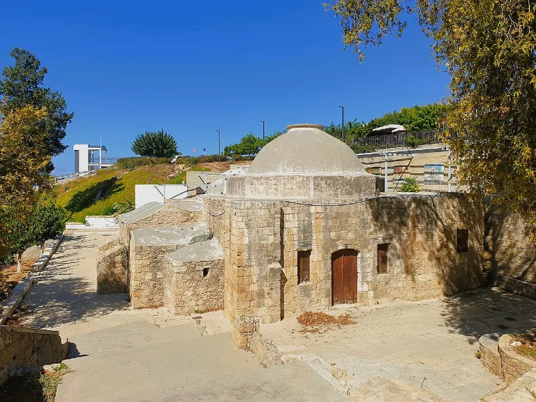
Ottoman baths in Paphos Old Town (Ktima)
Old town

Paphos Old Town (Ktima)

  • Getting there: approx. 11 km · 18 min

Municipal market, the Ottoman quarter of Mouttalos, Kennedy Square and small cafés: Ktima is where the locals live and work. Ideal for a morning stroll and easy to combine with the harbour and the Tombs of the Kings.

Paphos Old Town: market, sights & tips →

Open in Google Maps ↗

Photo: Chris06 / Wikimedia Commons, CC BY-SA 4.0, cropped
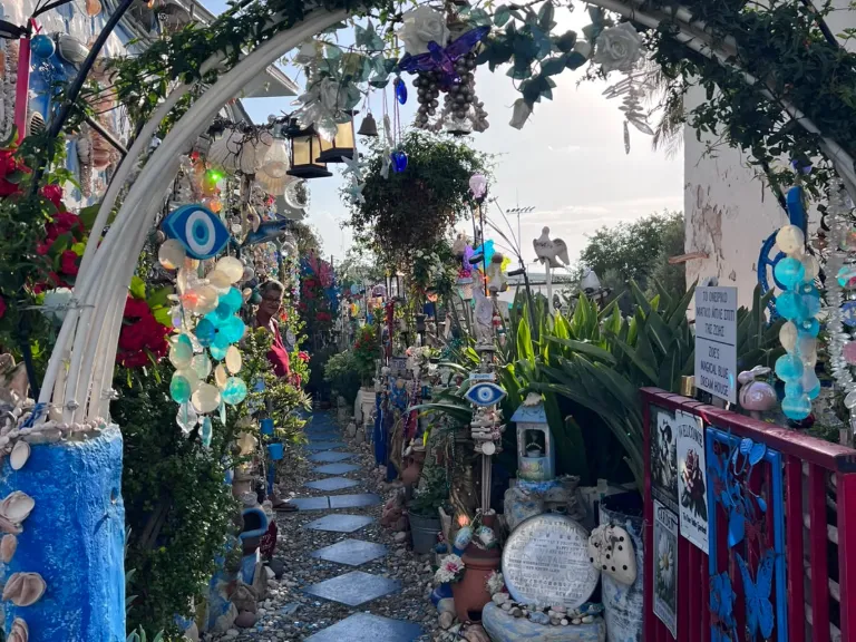
Entrance arch and blue garden path at the Blue Shell House in Paphos
Photo spot

Blue Shell House

  • Getting there: approx. 11 km · 17 min

A private home in the Moutallos quarter that its owner Zoe has covered from top to bottom with seashells, stones, glass and icons. Entry is free, a small donation is welcome.

Blue Shell House Paphos: our visit & tips →

Open in Google Maps ↗

Photo: Kimmy & Christian (own photo)

Akamas · the north
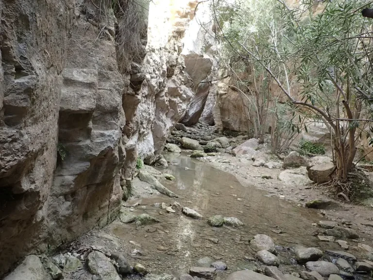
Steep rock walls in Avakas Gorge
Hiking

Avakas Gorge

  • Getting there: approx. 11 km · 30–40 min (partly gravel track)

A spectacular hike through a narrow limestone gorge with walls that are almost vertical in places. Sturdy shoes are a must; after heavy rain the gorge may be closed or dangerous. Early morning is the most pleasant time to go. Currently closed: according to the Department of Forests the trail has been closed until further notice since December 2025 (as of May 2026) – check before you go.

More about the Avakas Gorge

The Avakas Gorge is one of the best-known hikes on the Akamas coast. The Avgas river, which gives it its name, has cut through tilted limestone layers, and the walls close in to form a tunnel-like passage. The waymarked nature trail is 1.2 km long and takes about 45 minutes. Its final stretch follows the stream, which usually carries water all year round. Important: the gorge is currently closed (see below).

Nature

The gorge is a Natura 2000 site within Peyia state forest. It is home to the endemic, endangered Akamas centaury (Centaurea akamantis). With luck you’ll spot Cyprus wheatears, scops owls or kestrels.

Good to know

  • Currently closed: The Department of Forests closed the trail on 6 December 2025 until further notice, citing water flow, slippery ground and the risk of falling rocks (as of May 2026). Anyone who bypasses the barriers does so at their own risk. Check whether the gorge has reopened before you go.
  • Getting there: Take the road from Agios Georgios towards Toxeftra. The last stretch is gravel track.
  • Footwear: Sturdy, non-slip shoes are essential. You may get wet.
  • Best time: Early morning, before the heat builds.
Tip: The gorge can close at short notice after heavy rain, so plan your hike for a dry spell.

From our villas Asteria and Halia it’s 30–40 minutes to the trailhead, so once the gorge reopens you can easily finish the walk before lunch. Check availability →

Open in Google Maps ↗

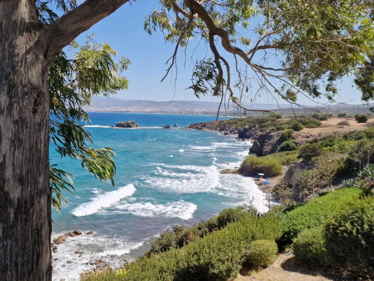
Photo: Krzysztof Ziarnek, Kenraiz / Wikimedia Commons, CC BY-SA 4.0, cropped
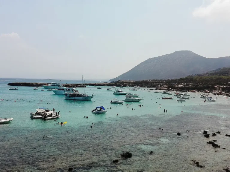
Turquoise bay with boats on the Akamas coast
Nature

Akamas Peninsula · Lara Bay

  • Getting there: from Agios Georgios via gravel tracks

A largely undeveloped nature reserve with secluded coves. Sea turtles lay their eggs at Lara Bay – the nests are protected, so please keep your distance. An off-road vehicle makes sense for the tracks; many guests book a guided jeep tour.

Akamas Peninsula & Lara Bay: turtle beach, directions & tours →

More about the Akamas Peninsula and Lara Bay

The Akamas Peninsula at the north-western tip of Cyprus covers about 230 km² and is largely undeveloped. No paved roads cross its mountainous interior, only tracks. It is named after Akamas, a son of Theseus. Of the 128 plant species endemic to Cyprus, 39 grow here. On its west coast lies Lara Bay, one of the beaches where sea turtles lay their eggs.

Turtles at Lara Bay

Loggerhead turtles (Caretta caretta) and green turtles (Chelonia mydas) nest on the beaches of Lara and Toxeftra. The females come ashore at night, and if they are disturbed they often abandon nesting, so the area is strictly protected.

Good to know

  • Rules (1 June – 30 September): According to the Department of Fisheries (as of 2025), umbrellas, sunbeds and tents are banned in the Lara-Toxeftra protected area. You may not stay on the beach from one hour before sunset or overnight.
  • All year: No driving on the beach, no fires, no pollution and no collecting ghost crabs.
  • Vehicle: From Agios Georgios the route follows gravel tracks. A 4×4 is advisable.
  • What to bring: Water and sun protection.
Tip: Keep your distance from marked nests and take all your rubbish with you. It helps turtles hatch here again next year.

From our villas Asteria and Halia it’s about 11 minutes to Agios Georgios, where the Akamas tracks begin, so you can set off early and be out in nature before the midday heat. Check availability →

Open in Google Maps ↗

Photo: Viaggiamocela / Wikimedia Commons, CC BY-SA 4.0, cropped

Ad
Akamas & Avakas Gorge by jeep tour
Guided small-group tour from Paphos with pick-up – handy if you’d rather not drive the gravel tracks in a hire car.
View jeep tour ↗
Rocky coastline with turquoise water near Latchi
Boat trip

Latchi · Blue Lagoon

  • Getting there: approx. 31 km · 40 min

Pretty harbour village on the north coast. Boats leave from here for the Blue Lagoon on the Akamas coast – turquoise water for snorkelling and swimming.

Latchi & Baths of Aphrodite: grotto, trails & tips →

Blue Lagoon Cyprus: getting there, boat trips & tips →

More about Latchi and the Blue Lagoon

Latchi is a small fishing village on the north coast, part of the municipality of Polis. Boats leave its harbour for the Blue Lagoon Cyprus, a bay on the Akamas coast with clear turquoise water. The bay is about 10 metres deep, with a sandy bottom and patches of seagrass. Underwater visibility is often more than 20 metres, ideal for swimming and snorkelling. Afterwards there’s fresh fish in the harbour tavernas.

Background

Latchi was once a small port that mainly shipped carobs. Its old stone warehouses now house restaurants and fish tavernas, and the marina has been expanded to hold around 220 boats.

Good to know

  • Boat trips: Several operators sail from Latchi. Check times and prices directly with them.
  • Best time: Morning, when the sea is calm and the water clearest.
  • Bring: Swimwear, snorkel and sun protection.
  • Time needed: Half a day to a full day with the boat trip and a meal.
Tip: Leave time after the boat trip for a fish lunch in one of the tavernas in the old harbour warehouses.

From our villas Asteria and Halia Latchi is about 40 minutes’ drive. Set off early and you’ll reach the lagoon ahead of most of the boats. Check availability →

Open in Google Maps ↗

Photo: Anastasius / Unsplash

Ad
Blue Lagoon without a car
Day trip from Paphos with pick-up: boat trip to the Blue Lagoon and a stop at the Baths of Aphrodite.
View excursion ↗
Waterfall

Adonis Baths

  • Getting there: approx. 8 km · up to 30 min (last stretch on a track)

Small waterfall with a natural pool in the hinterland, surrounded by legends of Aphrodite and Adonis. The site is privately run – check admission and opening times beforehand.

More about the Adonis Baths

North-west of the village of Kili, the waters of the Mavrokolympos gather into a small waterfall and natural pool: the Adonis Baths. The site lies in the hills behind Coral Bay, at around 270 metres above sea level. It makes a green change from the beach and is quick to reach, although the last stretch is on a track. It is privately run, which sets it apart from the state-managed sights.

About the name

The name “Adonis Baths” is recent: the landowner introduced it. The site has no connection with the historically documented Baths of Aphrodite near Latchi.

Good to know

  • Operator: Privately run, with an access fee. Check opening times and admission before you go.
  • Getting there: The last stretch is a track, so take it slowly.
  • Footwear: Non-slip shoes or water shoes. The rocks by the water are slippery.
  • Best time: Morning, before it gets busier.
Tip: Bring swimwear. The cool water in the pool is a real treat on a hot day.

From our villas Asteria and Halia it’s only about 8 km, up to 30 minutes depending on the track, a short outing that fits easily into half a day. Check availability →

Open in Google Maps ↗

Ad
To the Adonis Baths by quad or buggy
Guided quad or buggy tour around Coral Bay to the waterfalls.
View tour ↗

Day trips

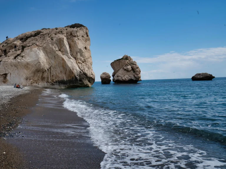
Aphrodite’s Rock (Petra tou Romiou) with pebble beach
Myth · viewpoint

Aphrodite’s Rock (Petra tou Romiou)

  • Getting there: approx. 36 km · 40 min

According to legend, the birthplace of Aphrodite: striking rocks in a pebble cove on the south coast. The best view is from the viewpoint above the road, especially in the late afternoon.

Aphrodite’s Rock: legend, getting there & tips →

More about Aphrodite’s Rock

On the south-west coast of the Paphos district, right beside the road to Limassol, Aphrodite’s Rock rises from a pebble cove. Legend has it that the goddess of love and beauty was born from the sea foam here and carried ashore. Petra tou Romiou is one of the most photographed spots in Cyprus, and it looks its best in late afternoon when the sun sits low over the sea.

Myth & name

The Greek poet Hesiod tells of Aphrodite’s birth from the sea foam in his Theogony. The name “Petra tou Romiou” means “rock of the Greek”. It refers to the Byzantine hero Digenis Akritas, who is said to have hurled huge rocks at Arab raiders.

Good to know

  • Viewpoint: The best view is from the lookout on the road above the cove.
  • Swimming: The sea here is often rough, so only swim when it’s calm. Climbing the rock is not allowed.
  • Best time: Late afternoon to sunset.
  • Time needed: 30–60 minutes.
Tip: Legend says swimming around the rock three times brings luck and love. Only try it when the sea is genuinely calm.

From our villas Asteria and Halia it’s about 40 minutes to the rock, so you can watch the sunset there and still be back in time for dinner. Check availability →

Open in Google Maps ↗

Photo: Datingjungle / Unsplash

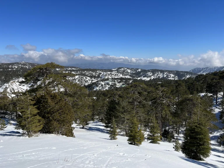
Snow-covered hills and pine forest in the Troodos Mountains
Mountains

Troodos Mountains

  • Getting there: approx. 89 km · 1 hr 40 min

The mountain range in the centre of the island, with Mount Olympos as its highest peak, mountain villages, wineries and Byzantine churches with frescoes that are part of the UNESCO World Heritage. Noticeably cooler than the coast in summer.

More about the Troodos Mountains

The Troodos Mountains in the heart of Cyprus are a world away from the coast: pine forests, villages on terraced hillsides and Mount Olympos, at 1,952 metres the island’s highest peak. In summer it’s noticeably cooler up here than by the sea. The valleys hide painted Byzantine churches and Kykkos, the region’s best-known monastery, and there are plenty of trails for walkers.

World Heritage & geology

Ten painted churches and monasteries have been on the UNESCO World Heritage list since 1985, including Asinou and St Nicholas of the Roof in Kakopetria. Their wall paintings span some 500 years, and their steep timber roofs are typical of the area. Since 2015 the range has also been a UNESCO Global Geopark: its rocks formed about 92 million years ago on an ocean floor.

Good to know

  • Time needed: Plan a full day.
  • Clothing: Bring a jacket. It’s noticeably cooler up top than on the coast.
  • Churches: Opening times vary from church to church, so check before you go. Cover shoulders and knees.
  • Roads: Winding mountain roads. Take your time and plan breaks.
Tip: Pick two or three churches or villages rather than trying to see everything. That leaves time for lunch in a village and a winery stop on the way.

From our villas Asteria and Halia it’s about 1 hr 40 min into the mountains, a full day out that makes a swim in your own pool that evening all the more welcome. Check availability →

Open in Google Maps ↗

Photo: Secret Travel Guide / Unsplash

Ad
Troodos as a guided day trip
From Paphos with pick-up into the mountains and villages – the route is long and winding, so you don’t have to drive yourself.
View day trip ↗
Good to knowDriving times are from Coral Bay beach, measured with the OpenStreetMap route planner (OSRM) and rounded. Cyprus drives on the left. A hire car is the most convenient option for Akamas and Troodos.
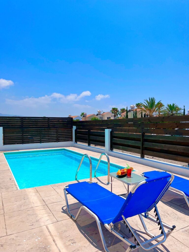
Private pool with sun loungers at Villa Asteria in Coral Bay

Your accommodation in Coral Bay

Two private pool villas, about a 10-minute walk from the beach – book direct with your host at the best price.

Check availability